Unlike in Peru, where thousands of tourists visit each year to climb the infamous Inca Trail up to Machu Picchu, Bolivia is hardly known for being home to impressive, well-preserved Inca routes.
But it does; routes which once criss-crossed the altiplano of Bolivia and Peru, connecting temples and the other important Inca sites which maed up the Inca Empire.
Tarija, in the south of Bolivia, is one of the least visited cities in Bolivia, yet it offers travellers the chance to walk one of Bolivia’s surviving Inca trails.
It is accessible and beautiful; located only two hours from Tarija in the Reserva Biológica Cordillera de Sama.
Added to this, Tarija is a perfect place to while away time before or after your walk.
With its year-round summer climate, proximity to some of the highest vineyards in the world and the locals’ propensity for dining at outside cafés and watching the world go by, it is an unexplored gem.
Walking the Inca Trail in Tarija, Bolivia
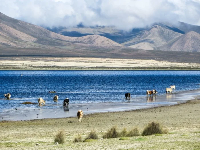
Starting in the Tajzara Lakes – a bus journey from Tarija – the route descends 2000m through splendid valleys, complete with stunning altiplano wildlife and incredible views across La Valle de la Concepción – Tarija’s wine region.
During certain seasons, the lakes brim with flamingos, so hikers can decide to spend a day admiring the views of the lake and camping beneath the stars, before spending the following lake descending along the Inca trail until reaching the tiny village of Pinos Sud, where transport should be available back to Tarija.
Advice
- The walk itself isn’t the most taxing but does require access to GPS or decent navigation skills as the path itself – while clear and defined for the most part – becomes much harder to follow towards the end of the route.
- At 3,400m above sea level, walking with full gear can be taxing and it’s wise to ensure you take plenty of water to help deal with the effects of altitude.
- There is no wood in the lake section of the walk (and little further down in the valley), so if you plan to cook, bring a stove.
- During the rainy season (November-February), any walking in Bolivia can be difficult or even treacherous. Ask locals about the conditions as this trek does require a river crossing which would not be advised during or after heavy rain.
- There are few places to camp once you start descending the Inca Trail. Make sure you either camp overnight at the lakes so that you can start early for the eight-hour descent the next morning or get a very early taxi to drop you off at the starting point. Be prepared that you may need to camp in your final destination of Pinos Sud or walk further down the main road back towards Tarija to get transport.
Preparation
Before you depart, visit the SERNAP office
The Sevicio Nacional de Areas Protegidas (SERNAP) administers the park and has an office opposite the bus station in Tarija, on Avenida Victor Paz Estenssoro (Avenida Las Américas).
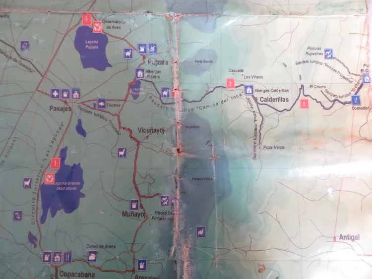
Although we weren’t required to register or pay to enter the park as was suggested in our guidebook, the office does have a reasonably useful map that will help you when it comes to planning your walk.
Although it was only a hand drawn ‘map’ of the reserve, it does indicate the names of the small villages that you will encounter which is useful for navigation purposes.
When we visited the office, they also very helpfully showed us on Google Earth the route, which looked well-trodden and easy to follow as it shadowed the river for a distance.
Don’t be fooled though: if you’re walking this during the rainy season, the riverbed becomes a torrent of water and the route becomes far longer and more difficult as you are forced to take the higher path which skirts the side of the hill instead.
Book a bus ticket from Tarija to Pujzara
From the bus station, you should be able to find local buses travelling to Villazón or Tupiza, both of which pass by the turn-off to the village of Pujzara.
This village is right next to the first of the three lakes, Lago Pujzara, and the entrance to the park; ask your driver to drop you off here.
The bus journey costs very little (15-25bs) and only takes around two and a half hours.
Organise camping equipment
Guidebooks suggest that there is a visitors’ centre on the shores of Lake Tajzara (and we did see something that looked possible) it definitely wasn’t open when we were there in March 2015.
I would recommend that you enquire with SERNAP in Tarija before departing if you want to stay there.
We took full camping equipment, including warm sleeping bags and this is invaluable if you are doing this trek alone.
We struggled to find the path at points, and having our tent meant that we were able to stop when we needed on the second day.
It is unlikely that you will come across any shops during your walk so it is best that you buy all of your food and water before you leave Tarija.
Remember to take warm, waterproof clothing
Walking at high altitude will always be a different experience than normal, and at 3,400m in altitude, trekking in Reserva Biológica de Sama requires decent clothing and equipment.
Make sure you have warm clothing, and it goes without saying that waterproofs are essential in the rainy season.
A hat is also highly advised – you’re much closer to the sun at this altitude!
The Route: Tarija – Tajzara Lakes – Inca Trail – Pinos Sud – Tarija
Tarija – Tajzara Lakes
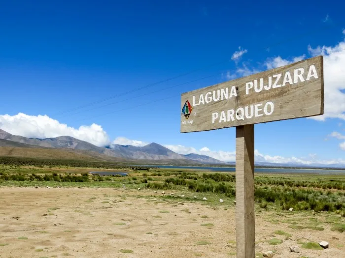
My brother and I took a bus from Tarija at around 8am and arrived in Pujzara at 10.30am.
Our plan was to walk the circuit of the lakes – admiring the beautiful wildlife and birdlife as we walked – before camping overnight at the side of the lake.
The second day we would walk to the pass, descend to the village of Pinos Sud and from there, take a taxi back to Tarija.
The route around the Tajzara Lakes
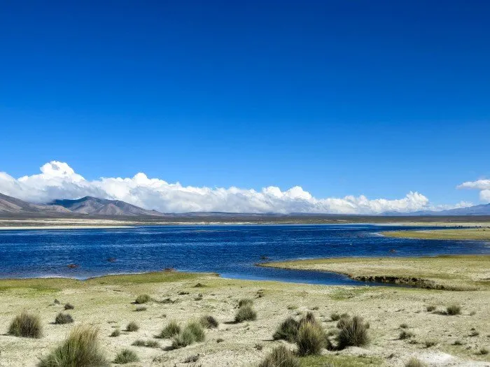
From the drop-off at Pujzara, the path is very clear and loops around Lago Pujzara to the right. Here we saw only a handful of flamingos: much fewer than we had seen a few days previously on the Salar de Uyuni tour circuit.
After about two hours of following the path, we saw another path peeling off to the left-hand-side, just before you reach the second, smaller lake of Laguna Patances.
If you don’t plan on walking the loop around the lake, then take the left turning here as it’ll cut a day off of your walking time.
The route around the lakes is a fair distance and took us around six hours to get to the bottom of Laguna Grande, a much longer time than we had anticipated.
We were also keen to find somewhere sheltered to camp as the path you follow is actually a road which occasionally sees some very high-speed traffic passing.
We decided to cut across the dunes to the south of the lake and cut the bottom of the route off, therefore bypassing Copacabana and instead ending up in Muñayoj.
This whole area is sand dunes and definitely an impressive landscape to hike in, but even more difficult to walk across, particularly when carrying full camping equipment.
After a good 45 minutes, we managed to find a sheltered location with some grass for us to pitch our tent.
This wasn’t easy as the sand dunes are particularly difficult to pitch a tent on. Also, be aware that local dogs will bark at you from a distance; I always made sure I had a rock to hand in case any came too close.
It was a very beautiful and peaceful place to camp, although the next morning trying to cut our way through back to the main path was hard work given the nature of the terrain and the number of spider webs connecting plants together and making it difficult to pass through.
It was roughly an hour and a half before we re-joined the road at Arenales, not Muñayoj, and another two and a half hours to arrive at the crossroads where we would take the turn right to join the path which would become the beginning of the Inca Trail.
Tajzara Lakes – Inca Trail

From here, it is a two hour gentle climb up to the pass along a well-defined road and which is marked at the top by a large stone cairn.
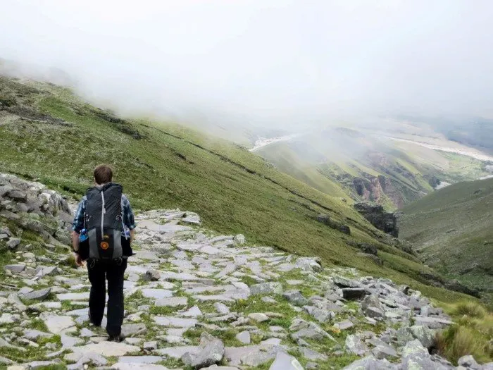
This path becomes a stone-lined Inca Trail, descending into the valley through a series of switchbacks for around two hours.
At the bottom of this initial Inca Trail, the path disappears, although there are occasional arrows which point you in the correct direction.
The map suggests that there is a community here called Calderillas, but we didn’t see much sign of people nor houses.
From here, you need to walk southeast to where two rivers meet and you enter a narrow gorge.
At this point, GPS can help you to ensure that you are heading in the correct direction towards the main river. It took us around another hour from the end of the Inca Trail to reaching the gorge.
Once you reach this gorge, you need to find a place to cross (a little wading or removing of your shoes will be required during rainy season) and follow the lower, well-trodden path on the side of the hill which climbs and falls for a number of hours as it follows alongside the river.
Inca Trail – Pinos Sud
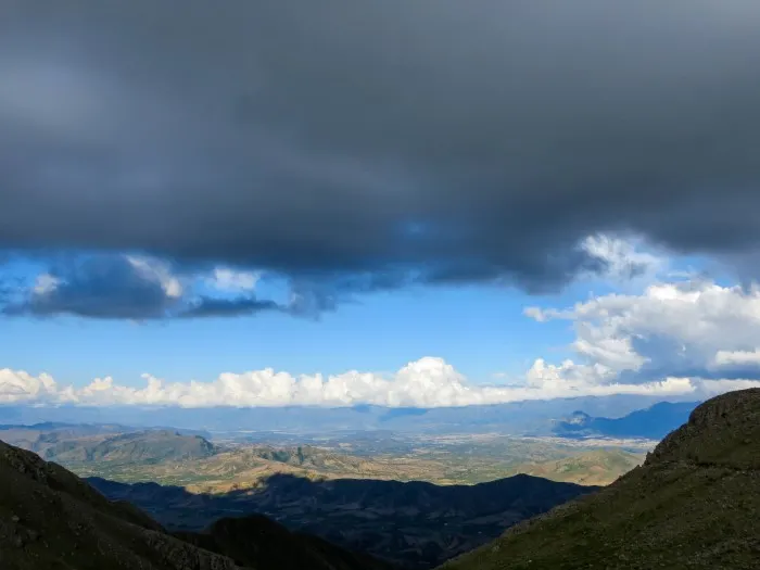
Finally, when the river heads off to the left, the path climbs upwards, mounting the hill to rediscover the Inca Trail in excellent condition and with exceptionally impressive views across Tarija and El Valle de la Concepción.
The descent to Pinos Sud is around 2000m of drop, and it took us a further two hours to reach the end of the Inca Trail (about 30 minutes before the village), where we decided to camp for the night.
From our wild camping spot, we had exceptional views of a sunset over La Valle de la Concepción and a chance to descend into Pinos Sud early the next morning.
Pinos Sud – Tarija
We were lucky to follow a farmer – who also turned out to be a taxi driver – down off the hill and who gave us a lift back to Tarija for around 30bs. If you’re not so lucky, walk to the main road towards Tarija and either flag down a micro, taxi driver or enterprising local.
Let me know in the comments section below of any other wild camping or walking that you’ve experience in Bolivia – I’d love to hear about your adventures!

Czickontheroad
Wednesday 13th of June 2018
I wanted to hike this trail but we run out of time, later I realized we slept by the lake when coming to Tarija - we had to take detour because roads were blocked and ended up sleeping here :-D
Steph Dyson
Saturday 30th of June 2018
Oh no! That's such a shame that you didn't realize you'd been there until afterwards!
South America Backpacker Four of the Most Adventurous Bolivian Treks - South America Backpacker
Tuesday 12th of July 2016
[…] Recommendations: Without any accommodation or food options on the route, it’s essential that you take a tent and cooking equipment. For more information, check out trekking Bolivia’s alternative Inca Trail. […]
Megan
Saturday 25th of June 2016
Hey Steph, We are thinking of doing this hike next week. Did you just use the GPS on your phone with Google maps/Earth? Or did you have an actual GPS. Also, how many kms would you say it was in total? We are thinking of doing it in one day since we don't have any gear. Did you already have yours or did you hire it? Thanks in advance, there's not much information on this one, your post was very helpful. Cheers.
Steph Dyson
Tuesday 28th of June 2016
Hi Megan, Sorry I've not been in touch sooner (it seems my site isn't informing me when I receive comments!). We actually got a map from the SERNAP office in Tarija (mentioned in the post) which was basically a hand-drawn map. It covered the basics but once you drop into the valley it does get a bit confusing as the path disappears. I'll upload that image to the post now. We didn't have GPS but have a lot of experience of walking. That said, having maps.me on you phone should be of some use (I'll admit that I don't know if the path is marked on the map as we didn't use it) should be helpful. I think you'll find it difficult to do in one day to be honest, particularly give that you won't arrive until mid-morning by bus to start the walk. I can't remember how many miles it was, particularly given we did the loop of the lakes to begin with. We already had all the gear and I think you will struggle to hire gear in Tarija itself as there's not much of a culture of walking in Bolivia. You might have some luck getting hold of gear in La Paz. Sorry I can't be more help! I hope you sort things and get a chance to walk the route - it is beautiful!
Neena
Sunday 17th of January 2016
Hi Steph, Wow! Stunningly beautiful. You are far more adventurous than I - and I must say that I am a bit jealous of your wanderlust. My excursions involve suburbia and are much less breathtaking.
Steph Dyson
Monday 18th of January 2016
Hi Neena! Yes it really is such a stunning walk along the Inca trail there! I don't we should measure how adventurous we're being though - as I argued in a previous piece (https://worldlyadventurer.com/what-does-adventure-travel-mean/) adventurous travel is all about our own limits but also our own context and how available adventure is! I know what you mean though, but I think suburbia can be very interesting, if perhaps a bit less breathtaking!
Megan Stetzel
Friday 15th of January 2016
Gorgeous pictures! This hike may have to make it onto my list for South America!
Steph Dyson
Friday 15th of January 2016
Yes it must! I'll be posting more beautiful hikes and adventures so stay in touch!