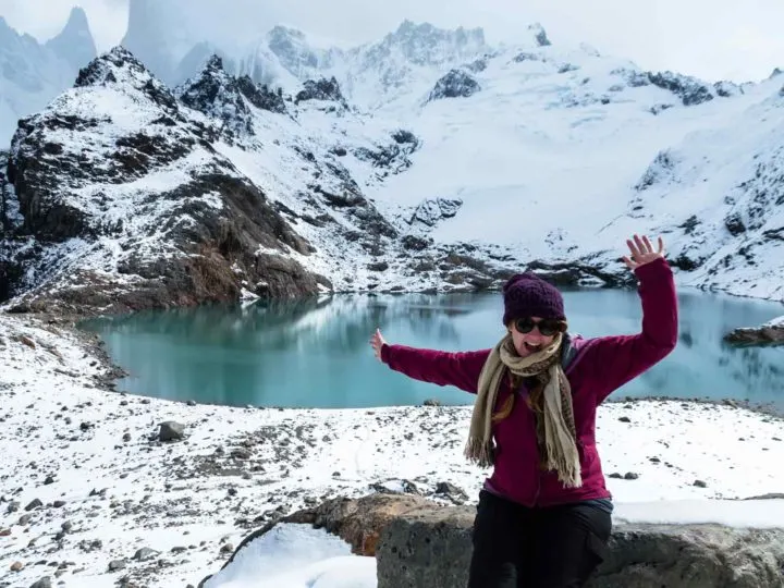
Home to the final, southernmost stretch of the Andes Mountains as they plunge into the Pacific Ocean, Patagonia is a remarkable place for hiking, particularly if you like wild terrain and scenery.
Some of South America’s most superlatively beautiful hiking trails crisscross this land of wind-pummelled grasslands, clusters of evergreen forests blasted by the elements, and sky-piercing mountains, many weighed down with glaciers of the deepest hues of blue.
If the promise of this scenery isn’t enough to get you packing your rucksack and out onto the trail, then I don’t know what will. But trust me: Patagonia is a paradise for hikers, with day and multi-day treks that will leave you wishing you could extend your trip indefinitely.
I’ve spent months exploring the wildernesses of Chilean and Argentine Patagonia and this list comes from mostly personal experience (although I’ll admit I’ve snuck a couple in that I haven’t had the chance to do – yet).

Join me on a jaunt around the region, with these fifteen of the best hikes in Patagonia.
A note about equipment for hiking in Patagonia
Patagonia is a rugged, remote, and untamed part of the world. Because of this, decent quality hiking gear, including hiking boots that you have worn on at least a few trails beforehand, is essential.
A day or larger pack, weather-appropriate clothing, and, if you’re staying overnight, a high-quality, lightweight tent and four-season sleeping bag will keep you safe and happy on these hikes.
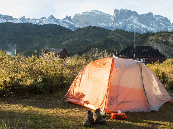
Camping in Patagonia is all part of the adventure and I definitely recommend that you build it into your trip; camping out in a remote place, far from civilization in the very far south of the planet is quite the experience.
While you can hike these Patagonian trails without a guide, I have listed companies that do offer guide services, and who will likely provide camping and cooking equipment (or meals) where required.
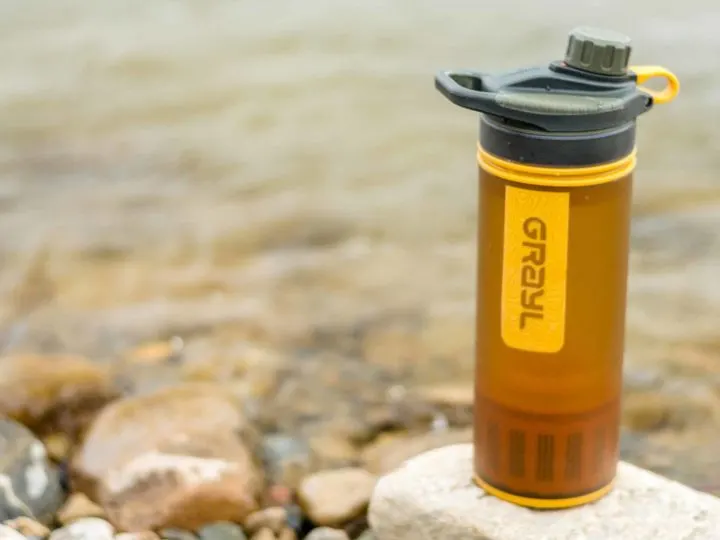
A lot of these hikes have fresh water along the trail, however, I recommend bringing water purification tablets or some backpack-friendly water filtration system (such as a Sawyer filter, Grayl Geopress, or Steripen – read our review of the latter).

Some hikes require camping and cooking equipment, as well as carrying several days’ worth of rations.
If this is your first time packing for a hiking vacation, be sure to read our guide to what to pack for Patagonia.
I’m a huge advocate of packing light, and this list covers everything from hiking clothing and boots to camping equipment, and other day-to-day gear that will make your life on the trail markedly easier and more comfortable.
You can also find detailed descriptions of all these hikes in Patagonia in Moon Chile, a guidebook I spent two years working on.
For detailed descriptions of the longer treks, check out the Lonely Planet Trekking in the Patagonian Andes book (although don’t both if you’re in the UK – it’s insanely expensive there for some reason but you can find cheap used copies to buy on other websites!).


When is the best time to hike in Patagonia?
The main season for visiting Patagonia is October through April. This is because of the weather, which can see snow and other inclement weather during the rest of the year. It’s also not advised to visit outside of these months because many hotels, tour operators, and national parks close.
The best time to hike in Patagonia is any time between October and April, although December through February is the high season for travel, so you’ll find trails busy and prices high.
The months of December, January, and February in Patagonia have the warmest temperatures, which hover around 15˚C (59˚F) and the days are long, with daylight lasting up to 17 hours. However, wind levels are high and can reach up to 190 kilometers per hour (120 miles p/h).
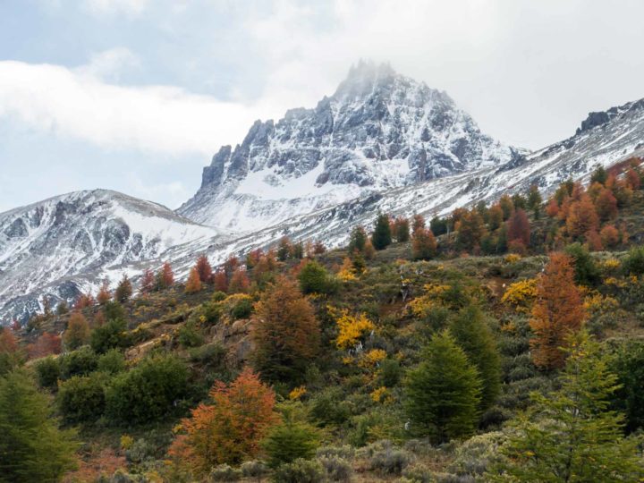
I always recommend visiting Patagonia in the fall months of March and April, when the landscapes turn a beautiful orange and red and temperatures hover around a mild 10˚C (50˚F) during the day – although they do drop below freezing at night. It’s a lot less windy than in summer, and there are also fewer visitors to Patagonia.
Another alternative is spring and the months of October and November. Patagonia during these months sees daytime temperatures of around 10˚C (50˚F) and winds are less fierce than in the summer, although they can be biting and, combined with overcast days, can lead to cold hiking conditions.

During winter, the region practically shuts down and heavy rain and snowfall close trails and even roads. Some destinations such as Torres del Paine are supposed to be spectacular, but you will need to go with a guide as entry is prohibited unless with a tour.
I re-visited Torres del Paine National Park in September and found that while the weather is cold – dropping well below freezing at night – it’s actually more settled than during summer, with lower wind speeds and, more often than not, bluebird skies.
Be aware that whenever you visit Patagonia, the chance of experiencing four seasons in a day – sun, rain, hail, and snow – is high and you’ll want to come prepared for every eventuality.
Best hikes in northern Chilean Patagonia (the Carretera Austral)
1. Volcán Chaitén, Pumalín National Park

- Duration: 4.5 kilometers (2.7 miles); 3 hours.
- Best time to go: Conditions for hiking are best between October and April, although the park is at its busiest between mid-December and February
- Difficulty: Medium
- Highest point reached: Unknown. Elevation gain of 625 meters (2,050 feet)
- Starting point: The trailhead lies 24 kilometers (15 miles) north of Chaitén
- Ending point: Same as starting point
- Must-have gear: The trail is steep and the path strewn with rocky boulders, including smaller lumps of glassy obsidian and pumice stones that were hurled out of the volcano when it erupted, so hiking poles are recommended. Bring plenty of water as there is none available on the trail.
- Do I need a guide? No. The trailhead is well-marked and the path is clear to follow. Your biggest issue is getting there from Chaitén as there is no public transport. Hitchhiking or joining a very affordable tour operated by Chaitur Excursiones is the easiest means of reaching the park
- Cost: Free
- Useful information: The national park has a comprehensive website, complete with trekking information for the Volcán Chaitén hike.
- Map: OpenStreetMap
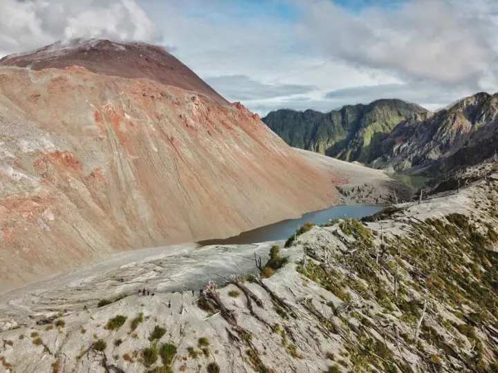
Volcano climbing is an activity that you can’t miss if you spend time in Chilean Patagonia. While Volcán Villarrica further north is perhaps the country’s most famous, Volcán Chaitén on the northern tip of Patagonia is equally impressive and the path up to the crater of this volcano easily ranks as one of the best day hikes in Patagonia, if not South America.
What’s more, the trail itself is short and sweet – if a steep climb. But, as you emerge out of the top of a grove of charred tree trunks (the debris left after the volcano erupted, when lahars of mud and ash blanketed the surroundings), the 45-minute ascent is more than worth it.
From the very top of the trail, you can appreciate the vastness of the volcano, and find yourself standing on the lip of its 3.5-kilometer (2-mile) crater.
As you do, keep an eye on the volcano itself. It’s still active, although currently offering nothing more dangerous than a tower of smoke puffing lazily from the top.
Other hikes in Pumalín National Park: the easy Sendero Alerces (0.7 km, 40 mins) is a beautiful short walk through protected alerce trees, while the medium Sendero Cascadas (5.6 km, 3 hrs) and Sendero Cascadas Escondidas (1.8 km, 2 hrs) reach some of the park’s most beautiful waterfalls. The hard Sendero Tronador (5 km, 4 hrs) and Sendero Volcán Michinmahuida (24 km, 8-10 hrs), the latter of which includes views of the snow-covered Michinmahuida Volcano, are also worth exploring.
2. Piedra del Aguila, Futaleufú

- Duration: 12 kilometers (7.5 miles); 2.5 hours
- Best time to go: Futaleufú is at its prettiest in the spring (October through mid-December) for wildflowers or fall (March-April) for the autumnal colors. Note that if you want to combine hiking with rating, the best season for the latter is November through March
- Difficulty: Easy; the ascent is gentle and on a gravel road
- Highest point reached: Unknown; the elevation gain is 420 meters (1,380 feet)
- Starting point: The center of Futaleufú
- Ending point: Same as starting point
- Must-have gear: Take water or a water filter for filling up from the river and extra layers for the top of the rock where it can be cooler and windy
- Do I need a guide? No
- Cost: Access is through private land, so if you see the owner, you’ll need to pay $1,000 CLP ($1.2 USD)
- Useful information: N/A
- Map: OpenStreetMap
Futaleufú might be better known as one of South America’s prime white-water rafting spots, but with the town in a picturesque river basin lined by forested mountains, there’s plenty to keep you busy on your own two feet.
Lying a few kilometers out of town, the Sendero Piedra del Aguila is an easy tramp up a gravel road to reach Eagle’s Rock, a jutting, 40-meter high lump of granite that grants sweeping views east across the valley towards two picturesque Alpine lakes.

It’s not the wildest of Patagonian scenery, but it’s an easy introduction to hiking in the region.
3. Sendero Mirador del Ventisquero (Glacier Viewpoint Trail), Queulat National Park

- Duration: 6.5 kilometers (4 miles); 2.5 hours
- Best time to go: This part of the Carretera Austral is best visited between October and April; outside of these months, snowfall can make the roads challenging and can close hiking trails
- Difficulty: Medium; the trail climbs continually to reach the viewpoint
- Highest point reached: Unknown; elevation gain of 305 meters (1,000 feet)
- Starting point: The ranger station at the entrance to Queulat National Park. To reach here, you can either hitchhike from Puyuhuapi or organize bikes through Turismo Experiencia Austral (who used to also operate minibusses but it’s not clear if that’s still an option)
- Ending point: Same as the starting point
- Must-have gear: A good quality Gore-Tex jacket as this part of the Carretera Austral is known for its heavy rainfall. The path can also be very slippery, so hiking boots with decent tread are essential
- Do I need a guide? No. The trail is well-marked
- Cost: $8,500 CLP ($10 USD) entry into the park
- Useful information: The national park has some basic information here
- Map: OpenStreetMap
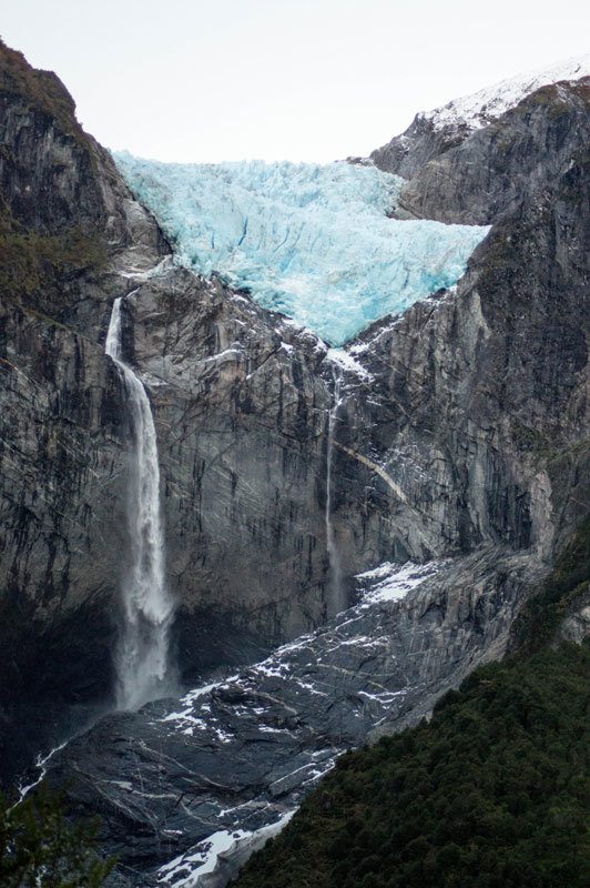
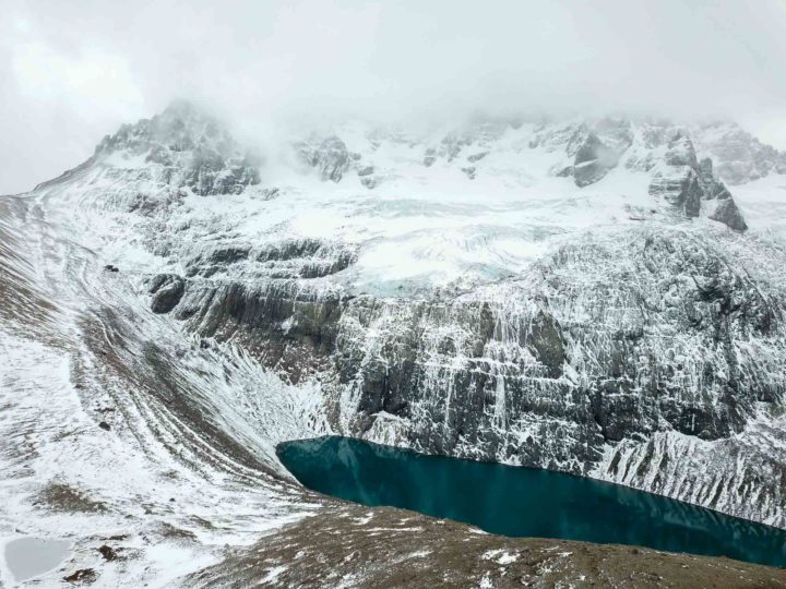
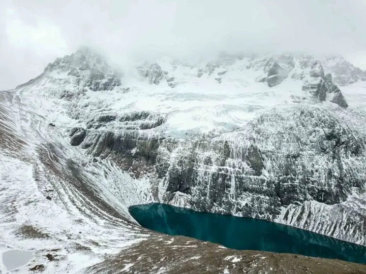
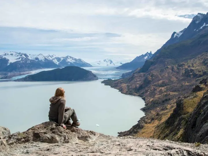
Wedged onto the cliff face high above a milk-blue lagoon, this glacier is one of the most magnificent in all of Patagonia, thanks to its magnificent colors and gush of meltwater that keeps the scene in motion.
One of the most iconic sights along the Carretera Austral is the egg-blue ice of the Ventisquero Colgante, the Queulat Hanging Glacier.
The light is better in the late afternoon, but, if you’re camping in the national park, you can take the short – if steep – trail, climbing through Valdivian temperate rainforest dripping with moss – at any time of the day.

Watching the dazzling blue ice crumbling in noisy avalanches from the glacier’s snout is a sight you’ll want to absorb for as long as possible.
Other hikes in Queulat National Park: The easy Sendero El Aluvión (1 km, 30 mins) and Sendero Laguna Témpanos (1.2 km, 30 mins, easy) are also worth exploring (get information here).
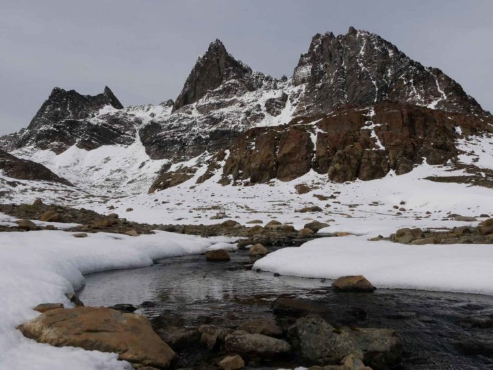
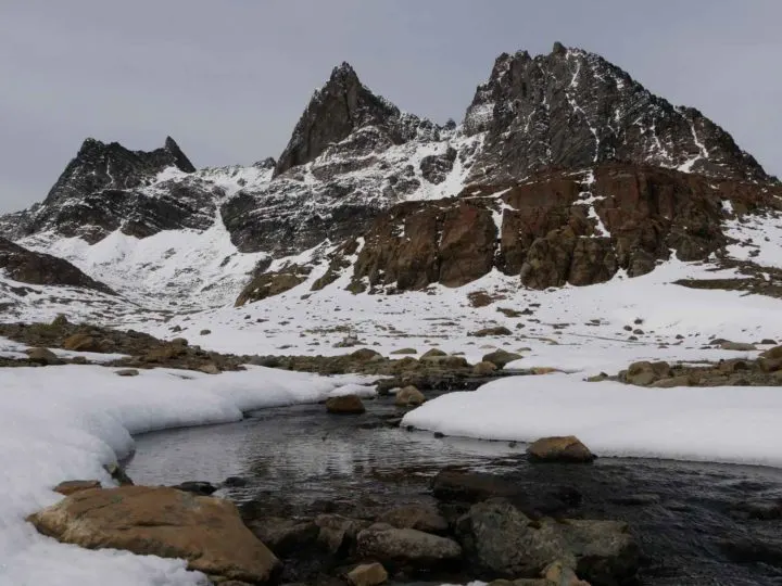
4. Cerro Castillo Traverse, Cerro Castillo National Park
- Duration: 51 kilometers (32 miles); five days
- Best time to go: The best time to hike in the park is January through March when wind speeds drop and the weather is mostly stable; the other recommended months are between November and December and April, although snowfall is possible during these periods
- Difficulty: Medium/hard
- Highest point reached: 1,300 meters (4,265 feet) at Paso El Peñón (El Peñón Pass)
- Starting point: The Las Horquetas entrance to the park, 30 kilometers (19 miles) north of Villa Cerro Castillo along the Carretera Austral
- Ending point: TheEstero Parada entrance to the park, 7 kilometers (4.3 miles) west of Villa Cerro Castillo
- Must-have gear: A sturdy tent that can withstand high winds and a waterproof jacket and pants that can do the same. Winds at the Paso El Peñón can be fierce
- Do I need a guide? No, but you do need some experience in backcountry hiking and being able to follow a trail, while accidents have occurred in the park when hikers were unprepared for the weather conditions. You must register with the park rangers when you pay your entry fee, as well as on your way out of the trail.
- Cost: $29,000 CLP ($35 USD) park entry; local company Senderos Patagonia run 5D/4N tours of the trail, including food and English-speaking guides starting from $1,350 USD
- Useful information: The national park has an excellent website that provides plenty of detail about the trail and how to prepare for it
- Map: OpenStreetMap and the national park website
Torres del Paine National Park in southern Chilean Patagonia might have captured most visitors’ imaginations, but if you’re looking for a trail that promises outstanding mountain scenery and just a small fraction of the visitor numbers, there’s a new national park in town: Cerro Castillo.
Its cornerstone trail is the Cerro Castillo Traverse (or Travesía Las Horquetas), a challenging trek through exposed mountain passes where the rewards are delivered in the form of panoramic views of glacier-studded peaks.

The most famous is the park’s namesake, Cerro Castillo, christened as such for its castle-like shape – and which looks, if only teeny bit, like the three granite prongs of Torres del Paine, situated, as it is, above a magnificent cobalt blue lagoon.
This hike combines pristine backcountry scenery of glittering lakes and gleaming glaciers, untechnical hiking, and few other hikers, making it a truly outstanding multi-day trek in Patagonia.
Other hikes in the national park: The challenging Sendero Mirador Laguna Cerro (14 km, 6-8 hrs) is a great day hike up to Laguna Cerro from where you can appreciate the castle-shaped peak. Information about it here.
5. Jeinimeni-Avilés Traverse, Sector Jeinimeni, Patagonia National Park
- Duration: 50 kilometers (31 miles); 3-4 days
- Best time to go: The trail is only passable between October and April due to snowfall and adverse weather conditions
- Difficulty: Hard
- Highest point reached: Unknown; elevation gain 1,084 meters (3,556 feet)
- Starting point: Laguna Jeinimeni in Sector Jeinimeni of the park
- Ending point: Stone House Campground in Sector Valle Chacabuco of the park; from here, it’s a further 26 kilometers (16 miles) to reach Los West Winds and the visitor center; you may be able to hitchhike with day visitors traveling this road
- Must-have gear: Light-weight camping and cooking gear, as well as sturdy hiking boots. A waterproof and windproof jacket, as well as plenty of layers for cold nights, are also essential. A water filter will allow you to safely drink water on the trail. A GPS or maps downloaded to your phone are also recommended
- Do I need a guide? You should only attempt this trail if you have extensive backcountry hiking experience, as the trail is remote and you are far away from help. River crossings are also necessary. Patagonia Xpress can potentially organize a guided trip
- Cost: Transport to the trailhead will cost $15,000 CLP p/p ($18 USD); camping at Valle Hermoso in Sector Jeinimeni costs $10,000 CLP ($12 USD) and at Stone House Campground costs $8,000 CLP ($10 USD). A taxi from here to Cochrane will cost $25,000 CLP ($30 USD)-$50,000 CLP ($61 USD), although in high season it may be possible to hitchhike
- Useful information: The national park has information about this trail on their website
- Map: OpenStreetMap
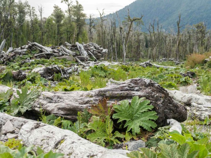
Patagonia doesn’t get much more incredible than in the remote wildernesses of Patagonia National Park, one of Chile’s flagship new protected areas.
Brimming with jagged mountains that fold into bewitching glacial lakes, the park is home to trails crossing gurgling rivers and through valleys of sun-burned grasslands and into verdant forests of southern beech, and none is more impressive than the Jeinimeni-Avilés Traverse.
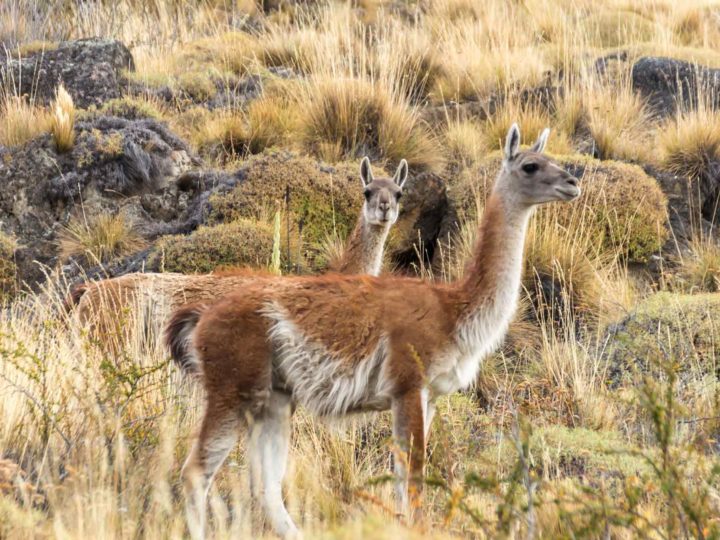
Spanning two sections of the park, Sector Jeinimeni and Sector Valle Chacabuco, this trail is a true challenge for the adventurous. The path is poorly marked, but the trek crosses the wildest parts of the national park, where huemul deer, guanaco, and even puma roam.
While this multi-day trek requires you to bring everything with you – you’re pretty damn remote, after all – the blindingly brilliant Patagonia vistas of undulating mountains and distant snow-dappled peaks will be more than worth it.
As one of Patagonia’s least-visited national parks, you’re also practically guaranteed to have the trail to yourself
Other trails in Patagonia National Park, Sector Jeinimeni: The Sendero Lago Verde (10 km, 2.5 hrs) takes you along the shores of Lago Jeinimeni to reach Lago Verde, both of which are similarly hued in electric blue. You can also turn this hike into the epic Patagonia National Park Trek (97 km, 5-6 days), which crosses Sector Valle Chacabuco and connects with the Paso Los Condores and the Ruta de Huemul to enter into Sector Tamango, the third part of the national park. Information about the latter here.
6. Lagunas Altas, Sector Valle Chacabuco, Patagonia National Park

- Duration: 23 kilometers (14.3 miles); 6-8 hours.
- Best time to go: Patagonia in March is characterized by fall colors as the southern beech forests blush red, but any time between October and April is a good time to hike
- Difficulty: Medium; the trail climbs steadily on an exposed hillside for the first few kilometers
- Highest point reached: 1,240 meters (4,070 feet) just before reaching the first of the lakes
- Starting point: Just above the Los Westwinds campground, in Sector Valle Chacabuco of the park
- Ending point: The visitor center, two kilometers (1.2 miles) east of Los Westwinds
- Must-have gear: A windproof coat and layers as it can be cold up on the high plateau where the lakes are situated
- Do I need a guide? No. The trail is well-marked and you can access maps from the visitor center in the park
- Cost: Free.
- Useful information: The national park has information about all trails and logistical information on their website
- Map: The national park has a downloadable map here
The sweeping river basin of Valle Chacabuco is speckled with grazing guanaco and a carpet of ochre grasses that rustle in the breeze, and it’s probably my favorite of the three sections of the brand-new Patagonia National Park.

While ground level is spectacular, the views are enhanced as you climb up into the hills along the Laguna Altas trail, one of my personal favorite day hikes in Patagonia. Ascending steadily up into the flank of Cerro Tamaguito and onto an exposed plateau, you’ll find cinematic views across the entire Chacabuco valley and beyond to Argentina.
Along the way, a series of aquamarine lagoons provide the ideal spot for a picnic and, if you’re lucky, you might spy a puma padding through the undergrowth nearby.
Other hikes in the national park: The hard Avilés Loop (16 km, 5-7 hours) gives you a chance to combat the final part of the Jeinimeni-Avilés Traverse, while the medium Lago Chico Loop (12 km, 4 hrs) circuits Lago Chico for panoramic views of Monte San Lorenzo, one of Patagonia’s highest peaks.
Best hikes in northern Argentine Patagonia
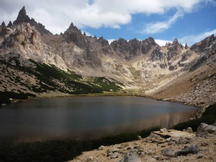
7. Nahuel Huapi Traverse, Nahuel Huapi National Park

- Duration: 47 kilometers (29 miles); 5 days
- Best time to go: The trek can be impassable due to snow until mid-December, with December through March the best months for hiking
- Difficulty: Hard; some of the trail is poorly marked and there are high ridges and scrambles to be overcome
- Highest point reached: 2,060 meters (6,760 feet)
- Starting point: Cerro Catédral ski resort, 16 kilometers (10 miles) west of Bariloche
- Ending point: Arroyo Lopez, 26 kilometers (16 miles) northwest of Bariloche
- Must-have gear: Camping equipment if you don’t plan on staying in the refugios; trekking poles for the exposed sections of scree, and sturdy hiking boots, are also essential. A GPS or mobile phone with maps downloaded and GPS capabilities are also helpful when the path is poorly-marked
- Do I need a guide? No, however experience of path-finding is essential as much of it is poorly-marked
- Cost: Free; bus to the trailhead costs a few dollars
- Useful information: This website and this one have detailed information about the different stages of the hike
- Map: Here
Hiking mecca Bariloche looks like a pleasant Swiss mountain village, with all the access to first-class trekking that you would expect. The nearby Nahuel Huapi National Park, with its craggy peaks and abundance of pristine mountain lagoons, is considered one of Argentina’s finest parks for the intrepid.
This five-day hike travels through an extremely remote part of the national park, with outstanding views of the region’s sparkling lakes (it’s part of the Argentine Lakes District, after all), picture-perfect volcanoes and the forest-fringed mountains that characterise this part of Patagonia.
Not only are the views epic, but the experience is one-of-a-kind, with remote mountain refugios offering a pleasant place to rest your head – and enjoy a beer – after a long day’s trekking in this spectacular part of Patagonia.
Best hikes in southern Chilean Patagonia
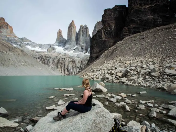
8. W trek, Torres del Paine National Park

- Duration: 80 kilometers (50 miles); 4-5 days
- Best time to go: Shoulder season (November/mid-December or late February-April) when the trail has far fewer hikers and the weather is still stable and relatively warm, and, in many cases, a lot less windy than in the summer months (December through February). Refugio and campground reservations are also easier to come by during these months. From May through September, you can only hike accompanied by a tour guide
- Difficulty: Medium; to make things easier, you can pay for food and a tent or bed in a refugio to ensure you only have to carry the bare minimum in your day pack


- Highest point reached: 900 meters above sea level (2,950 feet). The trail includes two days of elevation gain of 500-700 meters (1,640-2,300 feet)
- Starting point: Guardería Paine Grande (hiking west to east) or Portería Laguna Amarga (hiking east to west)
- Ending point: Portería Laguna Amarga (hiking east to west) or Guardería Paine Grande (hiking west to east)
- Must-have gear: A Gore-Tex raincoat and waterproof pants are essentials, as high winds and heavy rain are common in Torres del Paine National Park throughout the year. A rain cover for your rucksack and waterproof dry bags to protect your belongings inside are also highly recommended
- Do I need a guide? No. However, the reservation process for the campgrounds can be complicated and must be done at least three months in advance. More details can be found in this guide to reserving refugios and camping in Torres del Paine National Park, or you can use Torres Hike, a website that will save you time and hassle
- Cost: $214,000 CLP ($239 USD), including park entry, camping, and transport; around $1,500 USD for a tour. I recommend Chile Nativo, who give readers a 5% discount when you use the referral discount code “Worldly Adventurer”.
- Useful information: I’ve covered this hike in forensic detail, so read up on how to hike it without a guide and what to pack for Torres del Paine National Park
- Map: Here.
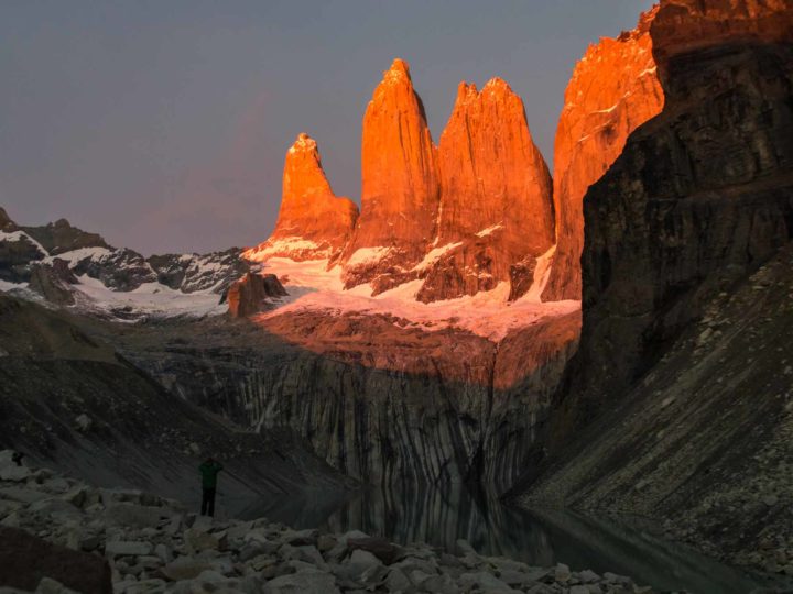
Torres del Paine National Park, with its cobalt blue lakes, wind-buffeted sweeps of hardy forest, and majestic peaks that rise in a jagged, snow-dusted mass out of the center of the park, is Patagonia’s poster child. It’s also home to one of the region’s landmark hiking trails.
A five-day trek that follows a W-shaped trail across some of the park’s most magnificent scenery, the W is an introduction to the soul-stirring qualities of Patagonia.
You trek through woodland and out again to face blinding panoramas, where you’ll admire Glacier Grey carving bergs the size of buses into silent waters beneath and stand in silence as you watch huemul picking through scattered vegetation beneath an amphitheater of mountains.
The final and most admired view, however, is Laguna Torres and the three granite towers after which the park is named, which, if you time it right, you can watch turning vivid orange in the light of sunrise. Once you reach the final viewpoint, head to the right along the ridge line, and you’ll get an even better view.
Other hikes in Torres del Paine National Park: There are dozens of hiking trails in the park, so read my guide to the best Torres del Paine day hikes for inspiration.
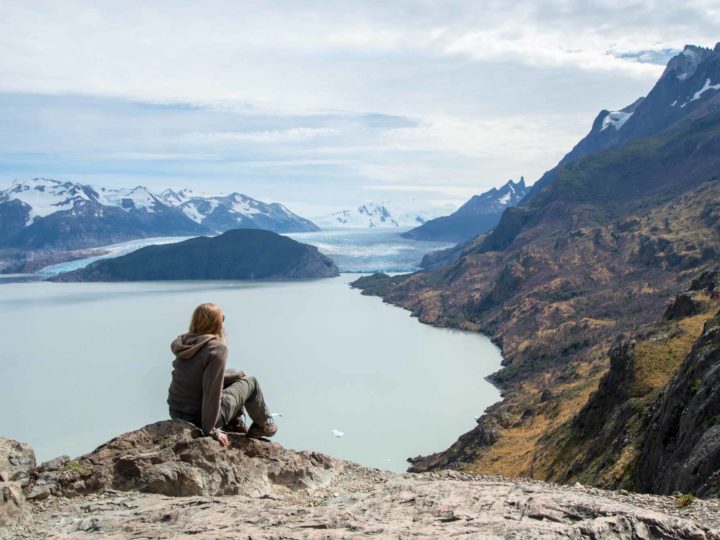
9. O Circuit, Torres del Paine National Park

- Duration: 136 kilometers (85 miles); 8-10 days
- Best time to go: As above. For this trail, hikers are only permitted between November and April; the trail is closed during the rest of the year
- Difficulty: Hard; to make things easier, you can pay for food and a tent or bed in a refugio to ensure you only have to carry the bare minimum in your day pack
- Highest point reached: 1,200 meters (3,940 feet) above sea level at the John Gardner Pass.
- Starting point: Portería Laguna Amarga
- Ending point: Same as starting point
- Must-have gear: As above. If you choose to self-cater, you will need to bring enough food for the duration of your hike, although small shops at the campgrounds along the W (which you join on day five) have basic supplies
- Do I need a guide? No. As for the O Circuit, the reservation process can be complicated and our article and Torres Hike are excellent resources
- Cost: $250,500 CLP ($280 USD), including park entry, camping and transport; $2,295 USD for a tour. I recommend Chile Nativo, who give readers a 5% discount when you use the referral discount code “Worldly Adventurer”
- Useful information: I’ve covered this hike in epic detail so read the complete guide to the Circuit, 14 things to know before you begin, and what to pack for hiking in Torres del Paine
- Map: Here
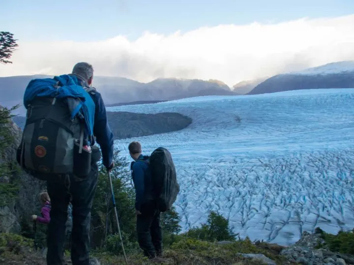
The O Circuit promises a glimpse into the remote heart of Patagonia that goes beyond the much-trafficked trail of the W.
Instead, this hike takes a sweeping loop of the Cordillera Paine range, meandering into the park’s northern zone where each morning you awake to a new day of glaciers slung in the mountains high above you and gushing water powering its way through furious rivers that accompany the trail for miles.
On day four, you reach the trail’s most enticing viewpoint. A morning’s strenuous climb up to John Gardner Pass brings you to a view of miles of the Southern Patagonia Ice Field, with its ridged glaciers extending beyond the horizon.

From here on in, you’re on the W trek, which you follow, bewitched, all the way to the final day and dawn rising over the towers.
Other hikes in Torres del Paine National Park: There are dozens of trails in the park, so read my guide to the best Torres del Paine day hikes for inspiration.
10. Hike to Cabo Froward, Punta Arenas

- Duration: 78 kilometers (48.5 miles); 5 days.
- Best time to go: The trek should only be attempted in summer (December through March) to avoid poor weather and rainfall that can make the river crossings even more perilous
- Difficulty: Hard; the trail is poorly marked and passes through remote and demanding terrain of forest and peat bog. Heavy rain means a likelihood of waist- to neck-high river crossings, so it’s essential you don’t attempt this alone. You’ll need to time your hike with the tide so that you can cross sections of the beach during low tide. SHOA, the Chilean navy’s hydrographic and oceanographic website, has tide tables
- Highest point reached: 365 meters (1,200 feet) at Cabo Froward
- Starting point: The trailhead begins at the end of the 9S road, 70 kilometers of Punta Arenas. You will need your own transport to get here, or hire the services of a taxi to drop you off and pick you up
- Ending point: Same as starting point
- Must-have gear: Sturdy dry bags for your belongings to protect them during the numerous river crossings
- Do I need a guide? Only those with considerable hiking experience should do this trek and you shouldn’t attempt it alone. The Puerto Natales-based Erratic Rock used to offer five-day, four-night Cabo Froward trekking tours (from $900 USD) – confirm with them directly whether this is still the case
- Cost: Free
- Useful information: Check out Wikitravel for a route guide
- Map: OpenStreetMap
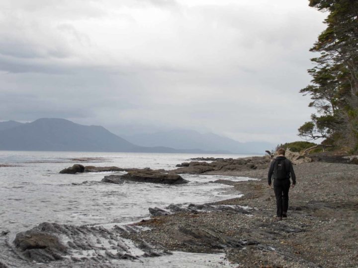
The roaring oceans tumble and churn beyond the shoreline, providing a fierce backdrop as you hike across the beach and through peat bog and rugged forest to the very southernmost point of continental South America: Cabo Froward.
This is Patagonia at its wildest and most untamed, with the cape marking the point where the Atlantic and Pacific Oceans combine in a seething mass.
The waves are your constant companions, so it’s fitting that Cabo Froward – and the end of the trek out – is marked by the towering Cruz de los Mares, the Cross of the Seas, which rises out of the landscape to tower above you.
It’s here where you should pause, breathing in the fierce winds and absorbing the views of the Strait of Magellan across to the deserted mountains of Isla Dawson.
Keep your eyes peeled for dolphins, whales, and other sea life as you pick your route back the way you came and onwards to civilization – although the feeling of being buffeted by the wind and isolated far from everyone else is one that will last with you a long time.
11. Dientes de Navarino, Navarino Island
- Duration: 53.5 kilometers (33 miles); 5 days
- Best time to go: The trail is only passable in the Austral summer, between the months of December and March, although extreme weather, including high winds, rain, and even snow are possible at any time
- Difficulty: Strenuous; you must carry all of your own camping equipment and food for the duration of the trek. The trail itself is poorly marked at times, which means extensive hiking experience, plus a working GPS, are essential
- Highest point reached: 860 meters (2,820 feet) at Paso Virginia
- Starting point: Western edge of Puerto Williams
- Ending point: 6 kilometers (3.7 miles) west of Puerto Williams
- Must-have gear: Light-weight camping and cooking equipment are essential, while a durable, waterproof jacket, pants, and rucksack cover will keep you and your things warm and dry. A GPS or phone with downloaded maps and GPS capacities is also essential to ensure you can follow the trail
- Do I need a guide? No, but anyone who does not feel 100% confident with their experience of hiking in remote and extreme environments should seriously consider hiring a guide. You must register with the police in Puerto Williams before beginning this trek
- Cost: Free without a guide; $2,395 USD with a tour company. Local company Explora Isla Navarino can organize guided tours, including transfers to and from the start of the trail and the services of a guide with satellite phone.
- Useful information: This website has great information
- Map: Here
If it’s remote, untouched Patagonia you’ve looking for on this list of hikes, then you’ll find it in the Dientes de Navarino, a trail that climbs through the final stretch of the Patagonian Andes and promises a true trekking adventure.
This five-day hike isn’t for the faint of heart of those without extensive trekking experience. But what you can expect is the truly wild, pristine, and mountainous scenery on what is officially the world’s southernmost long-distance hike.

Named after the toothy mountains that jut out of Navarino Island (so far south it lies beyond Ushuaia, often mistakenly considered the southernmost settlement in the world), this trail clambers across stark, rocky land dotted with lakes and sparse, scrubby vegetation.
If you’re looking for an experience of hiking at the very ends of the earth, the Dientes de Navarino is the one for you.
Other hikes in Puerto Williams: If you don’t fancy doing the full circuit, you can do a short hike up to Cerro Bandera (4 km, 2 hrs) for stunning vistas across the town and the Beagle Channel.
Best hikes in southern Argentine Patagonia
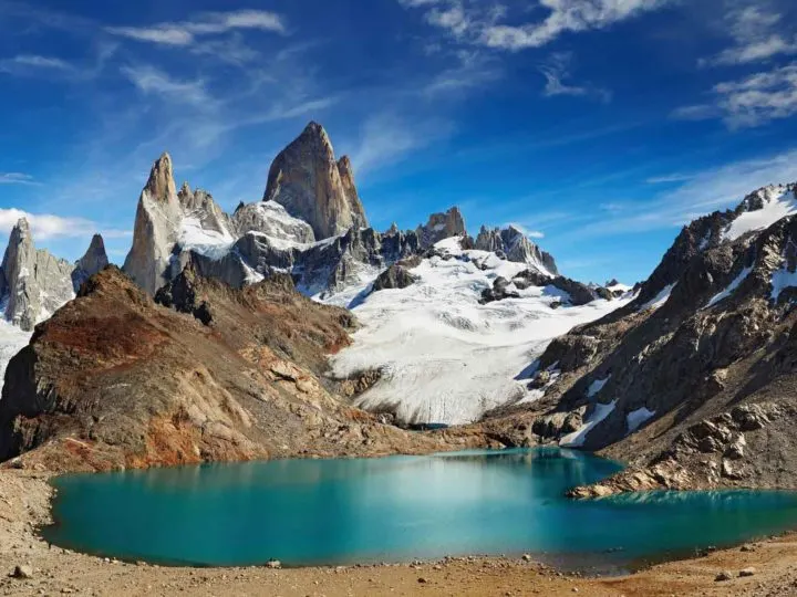
12. Laguna de los Tres, Los Glaciares National Park

- Duration: 23 kilometers (14 miles); 8-10 hours, although you can turn it into a two-day trek, a watch dawn break over Monte Fitz Roy, if you camp overnight at Campamento Poincenot, just below the final ascent to Laguna de los Tres. If opting for a one-day trek, make sure you start early.
- Best time to go: The trail is generally only open from October through April (after which heavy snowfall closes much of the park). Like Torres del Paine National Park, visitors peak between mid-December and February, when you may find yourself queuing to make the final ascent
- Difficulty: Medium/hard; much of the hike has a gentle ascent, but the final two kilometers (1.2 miles) are very, very steep
- Highest point reached: Unknown, but the elevation gain across the trek is around 700 meters (2,300 feet), with the final 400 meters (1,300 feet) coming in the final two kilometers (1.2 miles).
- Starting point: From the northern edge of El Chaltén, the town closest to this part of Los Glaciares National Park
- Ending point: Same as starting point
- Must-have gear: Sturdy hiking boots and trekking poles can help on the final ascent. If it’s raining, a good Gore-Tex waterproof coat will keep you dry, while you’ll want layered clothing (a fleece or other warm sweater) for the top, where it can get fiercely windy and cold
- Do I need a guide? No; plenty of other hikers on the trail will make it hard for you to get lost
- Cost: Free
- Useful information: This website has information about this trek and all others in and around El Chaltén
- Map: OpenStreetMap
Like the W trek and the torres of Torres del Paine, Laguna de los Tres has become the stuff of backpacking legend in Patagonia and you can’t go hiking in South America without attempting this trail.
The Laguna de los Tres trail’s fame stems from the way it picks its way through shady forests where woodpeckers and even rare huemul deer linger, and where the occasional openings in the trees give up broad views of Monte Fitz Roy.

But mostly, this reverence stems from the very end point of the trek where, after a lung-busting climb up and up over rocky scree you appear out on the shores of Laguna de los Tres, whose green-tinged glacial waters reflect the pronged peak of Monte Fitz Roy rising directly above.
While many choose to clamber up to this dazzling viewpoint as a one-day excursion from El Chaltén, if you’ve got the time, take a tent to pitch up in the basic Campamento Poincenot, just below the final ascent to the lake, and head up early the next morning for a truly unforgettable sunrise.
Other hikes in Los Glaciares National Park: The moderate trek to Laguna Torre (18 km, 9 hrs) allows you to experience the start of the Huemul Circuit and has spellbinding views of the Cordón Adela mountains and the often cloud-covered Cerro Torre; the trail to Chorrillo del Salto (4 km, 1.5 hrs), is an easy wander out to a pretty 20-meter waterfall; the steep trail to Mirador Los Condores (2.5 km, 30 mins) and Mirador Aguila (1.3 km extra, 30 mins more) has great views of Lago Viedma, as well as the prospect of spying condors.
13. The Huemul Circuit, Los Glaciares National Park
- Duration: 70 kilometers (43 miles); 4 days
- Best time to go: January and February see the best weather conditions on this hike and trekking should only be attempted between October and April. Shoulder seasons are far more challenging times to do this trek, as snowfall can prevent you from crossing the pass
- Difficulty: Strenuous; the trek includes two river crossings that often require the use of ziplines.
- Highest point reached: 1,550 meters (5,085 feet) at Paso del Viento (Windy Pass)
- Starting point: Southwestern edge of El Chaltén
- Ending point: Park ranger visitor’s center south of El Chaltén
- Must-have gear: Winds can reach up to 100 kilometers per hour, so bring plenty of layers and windproof, waterproof outer clothing to keep you warm. You will also need safety equipment (which you must show to the park rangers before you leave), including a harness, two carabiners, a safety line, and 20 meters of rope, all of which you can rent in El Chaltén; you will not be allowed to hike if you don’t have these. A GPS or phone with Organic Maps downloaded is essential, as the trail is poorly marked
- Do I need a guide? As much of the trail is poorly marked, you should not attempt this trek unless you have considerable map-reading experience, as very few people – and park rangers – are on the trails and if you get into difficulty, you’re on your own. You must register at the Centro de Informes Ceferino Fonzo for the national park in El Chaltén to get a hiking permit – this will ensure that the rangers come out looking for you if you don’t come back off the mountain
- Cost: Free; tours start from around $900 USD per person. Fitz Roy Expediciones is a good option for a guided trek
- Useful information: This blog post has a level of detail that even I’m impressed by!
- Map: Here
Laguna de los Tres might draw the day trippers, but Los Glaciares’ most superlative scenery is reserved for the most intrepid. The Huemul Circuit is just that.
What makes this trek an extraordinary adventure – and certainly among one of South America’s, if not the globe’s, best hikes – is the thrill of roaming the backcountry in this remote part of Argentina, picking your way past glaciers and around milky-blue glacial lakes.
But the most astonishing feature of this trek is the views from Paso del Viento, all the way across the Southern Patagonian Ice Field – an astonishing panorama of practically unending ice that shimmers beneath the sky.
The Huemul Circuit is by no means a walk in the park, but those who do it will find themselves safe in the knowledge that they may just well have encountered the finest views in all of Patagonia.
Other hikes in Los Glaciares National Park: The moderate trek to Laguna Torre (18 km, 9 hrs) allows you to experience the start of the Huemul Circuit and has spellbinding views of the Cordón Adela mountains and the often cloud-covered Cerro Torre; the trail to Chorrillo del Salto (4 km, 1.5 hrs), is an easy wander out to a pretty 20-meter waterfall; the steep trail to Mirador Los Condores (2.5 km, 30 mins) and Mirador Aguila (1.3 km extra, 30 mins more) has great views of Lago Viedma, plus the prospect of spying condors.
14. Crossing from Villa O’Higgins to El Chaltén (Chile/Argentina)

- Duration: 22 kilometers (13.7 miles) or an additional 10 kilometers (6 miles) if you don’t take the ferry on the first day; 2 days
- Best time to go: You can only take this route November through April, as the ferries stop operating outside of these months
- Difficulty: Medium
- Highest point reached: Unknown, although there are no high peaks to be climbed on this hike
- Starting point: Lago del Desierto, 35 kilometers (21.7 miles) north of El Chaltén along the Ruta 23, although the journey can be done in the opposite direction
- Ending point: Villa O’Higgins
- Must-have gear: Bring Chilean pesos, enough food for at least two or three days of waiting around for a boat, camping equipment, and plenty of warm and waterproof clothing
- Do I need a guide? No. Note that you may find yourself waiting for a couple of days for your ferry across to Villa O’Higgins if poor weather prevents the ferry from making the crossing
- Cost: Minibus to Lago del Desierto costs $20 USD (2 hrs); ferry across Lago del Desierto costs $28 USD; ferry from Canderlario Mancilla to Villa O’Higgins costs $36,000 CLP ($50 USD) direct to Villa O’Higgins or $82,000 CLP ($113 USD) via Glaciar O’Higgins.
- Useful information: You can make reservations for all of the bus journeys and boats, plus horses for cargo and the campsite at Candelario Mancilla, in advance here
- Map: OpenStreetMap
In Patagonia, even the border crossings between Chile and Argentina are an adventure, particularly the route between El Chaltén and Villa O’Higgins, one only passable on foot.
Starting on the shores of the azure Lago del Desierto, you’ll hike or take the ferry across to the northern edge of the lake, where the only way is on foot as you climb gently up into the mountains through wind-battered forests of southern beech, with Monte Fitz Roy crowing the sky behind you.
But that’s not all: after crossing the Chilean border and reaching the remote settlement of Candelario Mancilla, you’ll have to wait for your transport. It’s a boat that’ll take you past the calving ice giant that is Glaciar O’Higgins before dropping you onto the shores of the southernmost settlement along the Carretera Austral, Villa O’Higgins.
You’ll soon realize on this trail that every moment of this journey feels deliciously wild, untouched, and magical.
15. Cerro Guanaco, Tierra del Fuego National Park

- Duration: 8 kilometers; 8 hours
- Best time to go: November through March promise the best weather, as well as public transport to the park. A small number of campgrounds are also open in the national park during these months
- Difficulty: Hard; the trek gains 973 meters (3,190 feet) over just four kilometers, making the trail extraordinarily steep
- Highest point reached: 973 meters (3,190 feet) at Cerro Guanaco
- Starting point: From outside the Centro de Visitantes Alakush. The public bus from Ushuaia picks up and drops off here throughout the day; if traveling in a pair or more, it’s often cheaper to hire a car for the day than take the bus, which costs around $20 USD return per person
- Must-have gear: A pair of trekking poles will be invaluable in the muddy section of the hike as well as in the open scree
- Do I need a guide? No; the trail is well-marked
- Cost: $8 USD for park entry
- Useful information: Park website with basic information here
- Map: OpenStreetMap
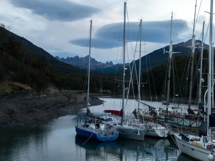
Flanked by a wall of mountains on its northern edge and the frigid, whale-filled waters of the Beagle Channel in the south, Ushuaia is Argentina’s southernmost city and has access to spectacular nature nearby.
Tierra del Fuego National Park has a handful of day hikes, but the gem in its crown is the challenging trek up Cerro Guanaco. It’s a sludgy, waterlogged climb once you exit the tree line and find yourself in a bog that merges into a staggeringly steep and bone-dry outcrop of scree.

A final clamber along the edges of this and you finally reach the top of Cerro Guanaco, from whose exposed crest the cinematic views of the Beagle Channel and the mountains of Navarino Island await.
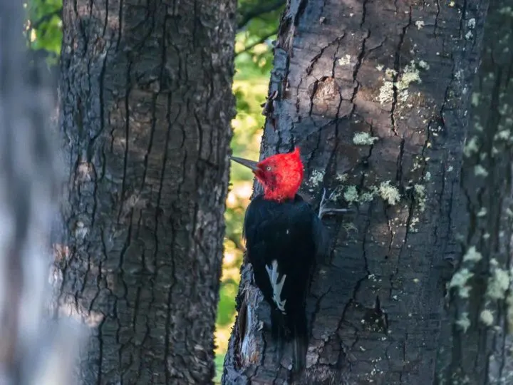
Keep your eyes peeled as you hike through the forests the first section of the trail, where red and black-headed Magellanic woodpeckers are resident.
Other hikes to do in Tierra del Fuego National Park: The easy Senda Costera (8 km 4 hrs) is a meandering coastal path with beautiful mountain views; the also easy Senda Pampa Alta (3 km, 1 hr) climbs up to a lookout for views of the Beagle Channel and the Valle del Río Pipo; the Senda Hito XXIV (7 km, 3 hrs) is an easy hike along the edges of Lago Acigami to reach the border with Chile and has lovely views across the Beagle Channel.
FAQs about hiking in Patagonia
Is Patagonia good for hiking?
Patagonia is considered one of the best places on the planet to hike! With the Andes Mountains cutting through the middle of Patagonia, it’s no wonder that the region offers excellent hiking. Destinations such as Torres del Paine National Park, Bariloche, and the new national parks along the Carretera Austral top of most trekkers’ bucket lists.
The best thing about hiking in Patagonia is that, despite the proximity to the mountains, none of the hikes in Patagonia are at altitude.
In fact, unless you’re a climber, you’re unlikely to reach over 1311 (4,301) meters above sea level – the elevation of Paso Viento, the highest point along Argentine Patagonia’s Huemul trek – on any of the hikes. As a result, there’s no need to worry about hiking at altitude in Patagonia.
Is hiking difficult in Patagonia?
It entirely depends on the hiking you choose to do. While the O Circuit in Torres del Paine National Park might be a moderately challenging eight- or nine-day trek, it’s still a great choice for people who’ve never embarked upon a multi-day hike before (although you certainly want to have day hiking experience before doing so!).
Patagonia is also home to plenty of one-day treks, including those such as the Lagunas Altas trail in Chile’s magnificent Patagonia National Park and the more famous Laguna de los Tres route in Argentina’s Los Glaciares National Park.
There are also plenty of moderate multi-day hikes, such as the five-day W trek and the four-day Cerro Castillo Traverse (both in Chile), plus difficult routes such as the four-day Huemul Circuit (also in Los Glaciares National Park) and Dientes de Navarino (on Chile’s Navarino Island). As a result, you can pick and choose trails that suit your ability.
How many days do you need to hike in Patagonia?
Patagonia is packed with hiking trails, so it really depends on how many you want to do! If you fancy the five-day W trek, then you’ll need at least a couple of days on each side to fly from Santiago to Puerto Natales, the closest airport to Torres del Paine National Park (the park in which the hike is located).
Additionally, if you plan on doing day or multi-day hiking in Los Glaciares National Park just across the border in Argentina, you’ll want at least three days (for day hikes) or four days for the Huemul Circuit, plus a couple of days to get there and back from Chile or from Buenos Aires.
If you fancy tackling the best treks in Bariloche, give yourself at least four days, while Chile’s Carretera Austral, with its glut of lesser-known national parks, needs at least two weeks if you plan on hiking the best trails.